
Analysing the Spatial structure of the Street network to understand the Mobility pattern and Landuse - A case of an Indian city - Mysore
DOI:
https://doi.org/10.6092/1970-9870/5652Keywords:
Spatial structure, Built environment, Urban street network, Mobility pattern, Space syntax, Patterns of movement.Abstract
Settlements grow and develop their unique spatial structure, subject to the factors influencing them. Later, the spatial structure starts influencing the functions of a settlement, like mobility, land-use, spatial expansion, etc. To understand the dynamics of the spatial structure and its influence in a rational way, a scientific analysis is necessary. So, space syntax measures are chosen as the principal theoretical postulates for analysis, because of its quantitative and scientific approach. In this paper, an attempt has been made to analyse the spatial structure of the street network in an Indian city – Mysore – by a comprehensive application of space syntax techniques. The study has been conducted by breaking down the structure into components and by analysing the use of different measures, like integration and choice, using Depthmap software (Turner, 2012). The analysis is then related to the existing mobility pattern and land-use to construe how the spatial structure influences the mobility pattern and land-use.
Downloads
References
Batty, M., Rana, S. (2002). Reformulating Space Syntax: The Automatic Definition and Generation of Axial Lines and Axial Maps. Centre for Advanced Spatial Analysis Working Paper Series 58, University College: London. Retrieved from http://discovery.ucl.ac.uk/185/1/working-paper58.pdf
City Form Lab. (Broadcaster). (2012, June 26). Massachusetts institute of technology, Urban Network Analysis Toolbox for ArcGIS. Podcast retrieved from http://cityform.mit.edu/projects/urban-network-analysis.html
Crucitti, P., Latora, V., Porta, S. (2004). Centrality measures in spatial networks of urban streets. The American Physical Society. Physical Review E 73, pp:1-5. doi: https://doi.org/10.1103/PhysRevE.73.036125
Henk, M., Bert van, W. (2003). Land Use and Mobility: A Synthesis of Findings and Policy Implications. European Journal of Transport and Infrastructure Research (ISSN:1567-7141), 3, no. 2, pp. 219-233. doi: http://www.ejtir.tudelft.nl/issues/2003_02/pdf/2003_02_06.pdf
Hillier, B., Hanson, J. (1984). The Social Logic of Space, Cambridge University Press: Cambridge. pp.108-109.
Hillier, B., Burdett, R., Peponis, J., Penn, A. (1987). Creating Life: Or, Does Architecture Determine Anything? Architecture et Comportment / Architecture and Behaviour, Volume 3, n. 3, 233 - 250. pp.237. Retrieved from http://discovery.ucl.ac.uk/101/1/hillier-etal-1987-creating-life.pdf
Hillier, B. (1999). The hidden geometry of deformed grids: or why space syntax works, when it looks as though it shouldn’t. Environment and Planning B: Planning and Design, Volume 26, pp.169-191. doi:https://doi.org/10.1068/b4125
Hillier, B. (2007). Space is Machine. Cambridge University Press: Cambridge. pp. vi. Retrieved from http://discovery.ucl.ac.uk/3881/1/SITM.pdf
Hillier, B., Lida, S. (2005). Network and psychological effects in urban movement. In Cohn, A. G., Mark, D. M. (eds) Spatial Information Theory: COSIT 2005, Lecture Notes in Computer Science number 3693, 475-490, Springer-Verlag, Berlin.
Hillier, B., Vaughan, L. (2007). The city as one thing. Progress in Planning, 67 (3) pp. 205-230. doi: https://doi.org/10.1016/j.progress.2007.03.001
Jiang, B., Claramunt, C. (April 25th -27th 2002). Structural approach to the model generalization of an urban street network. 5th AGILE Conference on Geographic Information Science, Palma, Mallorca, Spain: pp. 157 – 171. doi: https://doi.org/10.1023/B:GEIN.0000017746.44824.70
Karimi, K., Nooshin, M. (2003). The tale of two cities: Urban planning of the city Isfahan in the past and present. In 4th International Space Syntax Symposium, (Vol. 1, pp. 14-1). Location: London. Retrieved from http://www.spacesyntax.net/symposia-archive/SSS4/fullpapers/14Karimipaper.pdf
Karnataka Archives. (1865). Mysore city map in 1865.
McClure, W. R., Bartuska, T. J. (2007). Introduction: Definition, Design, and Development of the Built Environment, Part 1, Chapter 1, Page 4. Location: New Jersey. Publisher: John Wiley & Sons, Inc. Retrieved from https://pdfs.semanticscholar.org/ebad/e2fc6bae8ca5c8e825fbbd34e0fef7f27192.pdf
Moeinaddini, M., Asadi-Shekari, Z., & Zaly Shah, M. (2012). The Relationship between Urban Structure and Travel Behaviour: Challenges and Practices. Tema. Journal of Land Use, Mobility and Environment, 5(3), 47-63. doi:http://dx.doi.org/10.6092/1970-9870/1289
Mysore Urban Development Authority, MUDA. (2016a).
Mysore Master Plan Report 2031, Volume I. Chapter 1, Pages 1-5. Mysore: India. Retrieved from: http://mudamysore.gov.in/master_plan.htm [accessed on 5 April 2018].
Mysore Urban Development Authority, MUDA. (2016b). Mysore Master Plan Report 2031, Mysore Circulation _LPA. Retrieved from: http://justmysuru.com.md-in-23.webhostbox.net/mudamysore.gov.in/MasterPlan/Maps/6.%20ROAD%20CLASSIFICATION%2053000%20V4.pdf [accessed on 5 April 2018].
Mysore Urban Development Authority, MUDA. (2016c). Mysore Master Plan Report 2031, Mysore Proposed Land use Mysore city. Retrieved from: http://justmysuru.com.md-in-23.webhostbox.net/mudamysore.gov.in/MasterPlan/Maps/4.%20PROPOSED%20LANDUSE%20CITY%20V3.pdf
Parthasarathi, P. (2014). Network structure and metropolitan mobility. The journal of Transport and Land Use (ISSN: 1938-7849). pp153-170. doi. https://www.jtlu.org/index.php/jtlu/article/view/494/436
Parsons, Constance E. (1930). Mysore City: Mysore city map in 1930. pp 202. Oxford University Press. Retrieved from: https://archive.org/details/MysoreCity1930
Penn, A., Turner, A. (2003). Space layout affects search efficiency for agents with vision, proceedings from 4th International Space Syntax Symposium, London. pp.9.1-16. Retrieved from: http://www.spacesyntax.net/symposia-archive/SSS4/fullpapers/09Penn-Turner.pdf
Salheen M. A. (2003), An application of universal distance using space syntax analysis, proceedings from 4th International Space Syntax Symposium, London. pp.36.1-13 Retrieved from: http://www.spacesyntax.net/symposia-archive/SSS4/fullpapers/36Salheenpaper.pdf
Space Syntax. (2011). Create Space: Create Value. pp.19. Retrieved from: http://www.spacesyntax.com/wp-content/uploads/2011/11/Space_Syntax_General-Practice-Brochure_1209.pdf [Accessed on September 17, 2017].
Space Syntax Network. (2017). Software. Retrieved from: http://www.spacesyntax.net/software/ [Accessed on 5th April 2017].
Tim Stonor. (2009a). New settlements and Urban Extensions [Lecture Notes Online]. Retrieved from: https://timstonor.wordpress.com/2009/03/26/new-settlements-urban-extensions/#more-91 [Accessed on 17 September 2017].
Tim Stonor. (2009b). Place making in a regional setting [Power Point Slides], Slide 4. Retrieved from: http://www.slideboom.com/presentations/82687/Placemaking-in-a-regional-setting [Accessed on June 10 2017].
Tim Stonor. (2010). The role of space in the creation of place [Power Point Slides], Slide 13. Retrieved from: http://www.slideboom.com/presentations/82687/Placemaking-in-a-regional-setting [Accessed on 20 May 2017].
Tim Stonor. (2011). Intro to Space Syntax Day 1. In: Harvard University Graduate School of Design Cambridge: UCL Space Syntax [Power Point Slides]. Slide 10. Retrieved from http://www.slideboom.com/presentations/292558 [Accessed on 18 May 2017].
Tim Stonor. (2014). Predictive Analytics for urban planning, building design and spatial economics. [Power Point Slides]. Slide 4. Retrieved from https://www.slideshare.net/tstonor/tim-stonor-predictive-analytics-using-space-syntax-technology [Accessed on 10 June 2017].
Turner, A. (2012). Depthmap (Version 10.14) [software]. Retrieved from https://www.ucl.ac.uk/bartlett/architecture/research/space-syntax/depthmapx
UCL Space Syntax. (2017). Overview. Retrieved from: http://otp.spacesyntax.net/overview-2/ [Accessed on 5th April 2017].
Downloads
Additional Files
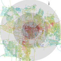
- Figure 1_ Mysore Study Area
- Figure 2_ Mysore 1865
- Figure 3_ Mysore 1897
- Figure 4_ Mysore 1930
- Figure 5_ Mysore 1976
- Figure 6_ Mysore 2011 Choice
- Figure 7_ Mysore 2011 Integration
- Figure 8_ CBD Integration
- Figure 9_ CBD Choice
- Figure 10_ CBD Landuse
- Figure 11_ CBD Circulation
- Figure 12_ Jayalakshmipuram Integration
- Figure 13_ Jayalakshmipuram Choice
- Figure 14_ Jayalakshmipuram Landuse
- Figure 15_ Jayalakshmipuram Circulation Pattern
- Figure 16_ Kumbar Koppal Road
- Figure 17_ Tenalirama Road
- Table 1_ Mysore 1865 choice
- Table 1_ Mysore 1865 Integration
- Table 1_ Mysore 1898 Choice
- Table 1_Mysore 1898 Integration
- Table 1_ Mysore 1930 Choice
- Table 1_ Mysore 1930 Integration
- Table 1_ Mysore 1976 Choice
- Table 1_ Mysore 1976 Integration
- Table 6_ Kumbar koppal choice
- Table 6_ Kumbar Koppal Integration
- Table 6_ Kumbar koppal Landuse
- Table 6_ Kumbar Koppal Connectivity
- Table 7_ Tenali rama road choice
- Table 7_ Tenali rama road Integration
- Table 7_ Tenali rama road Landuse
- Table 7_ Tenali rama road Connectivity
Published
How to Cite
Issue
Section
License